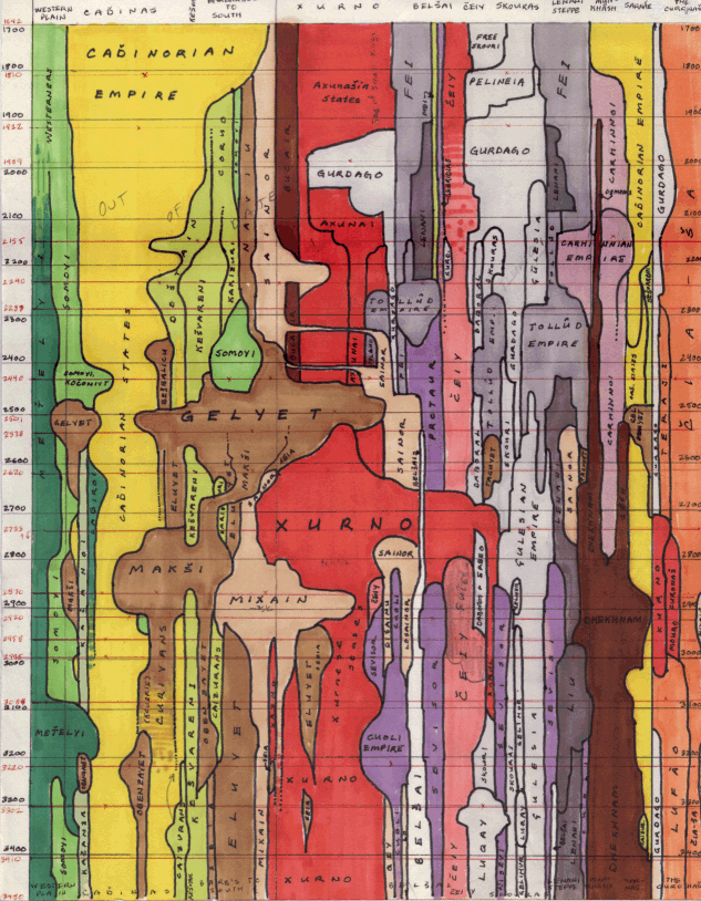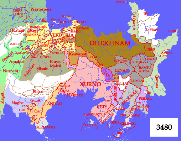

 This map of Ereláe might help with the regions.
The color scheme for the language families is the same, except that for some reason the Carhinnoi/Qaraumcán
have mutated from light purple to olive green. The map is for
ZE 3480, which corresponds to the bottom of the diagram.
If the type is too hard to read, the regions are, left to right, the Western Plain; the Cadhinorian Plain; the Barbarian Plain; Axunai/Xurno; Belshai; Cheiy; Skouras; the Lenani Steppe; Munkhâsh/Dhekhnam; Sarnáe (= western Dhekhnam); the Curanásh (= the eastern coast of Luduyn).
I created the first version (and the first 6000 years) of the Atlas map by map, eventually orchestrating a continental crisis that poised Munkhâsh to dominate Cadhinas, Axunai and the Lenani steppe all at once.
That was fun, but the remaining 1800 years were more daunting. Ancient times consisted largely of individual civilizations arising in their own areas. Now they had to interact, and the barbarians in between, now militarily dominant, were more important than ever. I had no idea how to proceed, going map by map.
The solution was the above diagram. I could visualize the entire epoch at a glance, plot the rise and fall of empires, move peoples around, move other peoples around in response to that. (E.g. notice how the Sainor move around after the rise of the Gelyet.) The diagram also helped avoid another problem of going map by map: leaving some regions to stagnate. This would be readily apparent on the diagram.
The black horizontal lines mark the centuries; the red lines are the dates I made maps for.
I should also mention that some names have changed. Skourene names used to follow a Greek model; I decided to make them look more Indic. And Xurnese names have recently been completely reformed; Cheiy is now known as Teô. The diagram is out of date in other ways as well; often, better ideas occurred as I was doing the actual maps. (The three empires of Gurdago, for instance.)
